Latest news
23 December 2025
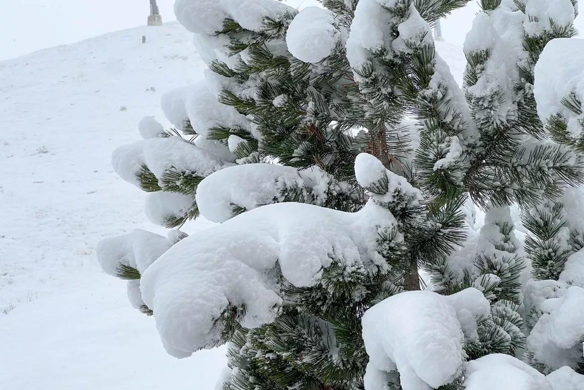
Live from the snow dump: it’s absolutely dumping right now!

A southern current has brought a spell of warm weather to the Alps and it currently feels like spring, with the snow line hovering elusively above 2000 metres and temperatures of up to 20 degrees in the valleys. Fortunately for skiers and snowboarders, change is on the way. Starting Friday the weather should start to turn, with the snow line dropping and some precipitation in the forecast.
At the time of writing it's particularly mild in the Alps, especially the northern Alps due to a southern Foehn wind. Only in the Italian Alps is the snow line consistently below 2000m - it's currently at about 1600m altitude and the country is expecting light flurries starting Thursday. From Friday, west-southwest winds will brings some precipitation to the Alps, and in the run-up to Christmas precipitation is expected almost daily. However, the snowfall will vary considerably between regions, with the most precipitation expected for the Italian Alps - as much as 120cm above 2000m in Aosta. Up to a metre of fresh snow is also expected in Switzerland (Ticino and Graubünden) and France (Hautes Alpes).
It's the French, Italian and Swiss Alps that will be getting the first dump of snow, then, starting Friday. Austria will have to be patient for now - the country is only expecting up to 15cm of snow on Saturday, with the snow line dropping to 1300m. Sunday and Monday will see changing winds that bring precipitation to the northern ski area. Between the snowfall on different days there should be dry periods during which skiers and snowboarders can enjoy the fresh snow - namely Saturday and Tuesday, when little precipitation is expected.
The snow line is expected to fall starting Friday. The first precipitation to fall that day will unfortunately be rain in most places up to 2000m, but in the afternoon the snow line may drop as low as 1200m above sea level. At the weekend, the snow line is expected to drop to 1400m in the Italian Alps and as low as 800-1200m in the French and Swiss Alps. The snow line will also descend gradually in the Austrian Alps, down to 700m in Tyrol on Monday.
\With all the fresh snow expected daily starting Friday, the avalanche risk goes up, especially in the Italian, French and Swiss alpine regions which are expecting abundant snowfalls. We strongly recommend staying on-piste and heeding safety advice and warnings from your ski area.
Born and raised in the ski paradise of Vancouver, Canada, I learned to ski before I can remember, balancing precariously on my parents’ skis as they sailed down the hill. I started snowboarding in my teens and am now delighted to be exploring everything Europe’s ski scene has to offer!