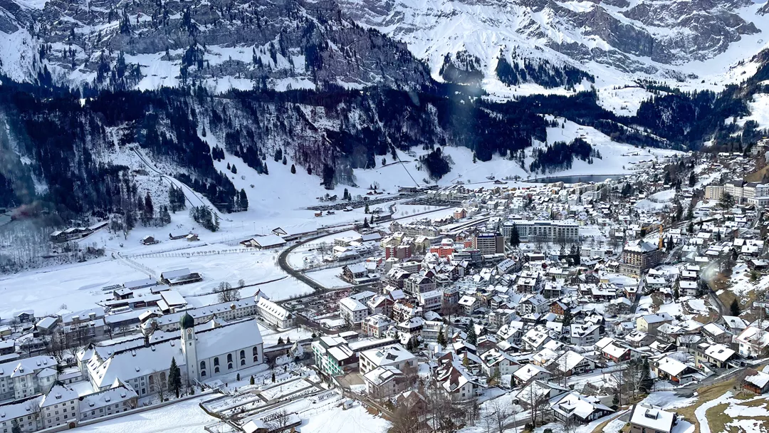
What is the weather like in Engelberg in Switzerland, and what is the forecast for the next few days? Check the current weather forecast for Engelberg on this page. Here, you will find the weather forecast for the next 48 hours as well as the next 14 days, so you’ll know exactly what to expect and what the weather will be like in Engelberg during your winter holiday.
The weather in Engelberg
On this page, you will find the current weather forecast for Engelberg, located in the ski resort of Engelberg in Switzerland. Check the forecast and temperature for both the valley and the mountain. This will help you see what conditions will be like on the slopes and whether you need to add an extra layer for the day’s skiing. Will snow be in the forecast, or will the sun be shining? And what about the wind? How high is the frost line (0-degree limit), and what is the current snow depth in Engelberg? Read on for all this information!
Jump directly to:
48-hour weather forecast for Engelberg
03 April 2026
Night
Expectation 0 mm
0-degree limit 1412 metres

-1°C

Morning
Expectation 0 mm
0-degree limit 1493 metres

3°C

Midday
Expectation 0 mm
0-degree limit 1889 metres

8°C

Evening
Expectation 0 mm
0-degree limit 1828 metres

4°C

04 April 2026
Night
Expectation 0 mm
0-degree limit 1927 metres

2°C

Morning
Expectation 1 mm
0-degree limit 2215 metres

6°C

Midday
Expectation 0 mm
0-degree limit 2629 metres

12°C

Evening
Expectation 0 mm
0-degree limit 2760 metres

7°C

03 April 2026
Night
Expectation 0 mm
0-degree limit 1453 metres

-13°C

Morning
Expectation 0 mm
0-degree limit 1554 metres

-10°C

Midday
Expectation 0 mm
0-degree limit 1892 metres

-7°C

Evening
Expectation 0 mm
0-degree limit 1807 metres

-8°C

04 April 2026
Night
Expectation 0 mm
0-degree limit 1943 metres

-8°C

Morning
Expectation 1 cm
0-degree limit 2263 metres

-4°C

Midday
Expectation 0 mm
0-degree limit 2642 metres

-2°C

Evening
Expectation 0 mm
0-degree limit 2750 metres

-4°C

14-day weather forecast for Engelberg
Date
Weather and snow
Expectation
Wind
Frost line
Date
Weather and snow
Expectation
Wind
Frost line


1412 metres
Date
Weather and snow
Expectation
Wind
Frost line


1897 metres
Date
Weather and snow
Expectation
Wind
Frost line


2696 metres
Date
Weather and snow
Expectation
Wind
Frost line


2458 metres
Date
Weather and snow
Expectation
Wind
Frost line


2936 metres
Date
Weather and snow
Expectation
Wind
Frost line


2630 metres
Date
Weather and snow
Expectation
Wind
Frost line


2039 metres
Date
Weather and snow
Expectation
Wind
Frost line


1710 metres
Date
Weather and snow
Expectation
Wind
Frost line


1665 metres
Date
Weather and snow
Expectation
Wind
Frost line


1671 metres
Date
Weather and snow
Expectation
Wind
Frost line


1490 metres
Date
Weather and snow
Expectation
Wind
Frost line


1771 metres
Date
Weather and snow
Expectation
Wind
Frost line


1807 metres
Date
Weather and snow
Expectation
Wind
Frost line


2028 metres
Date
Weather and snow
Expectation
Wind
Frost line


1453 metres
Date
Weather and snow
Expectation
Wind
Frost line


1943 metres
Date
Weather and snow
Expectation
Wind
Frost line


2696 metres
Date
Weather and snow
Expectation
Wind
Frost line


2470 metres
Date
Weather and snow
Expectation
Wind
Frost line


2936 metres
Date
Weather and snow
Expectation
Wind
Frost line


2630 metres
Date
Weather and snow
Expectation
Wind
Frost line


2039 metres
Date
Weather and snow
Expectation
Wind
Frost line


1710 metres
Date
Weather and snow
Expectation
Wind
Frost line


1665 metres
Date
Weather and snow
Expectation
Wind
Frost line


1671 metres
Date
Weather and snow
Expectation
Wind
Frost line


1490 metres
Date
Weather and snow
Expectation
Wind
Frost line


1771 metres
Date
Weather and snow
Expectation
Wind
Frost line


1807 metres
Date
Weather and snow
Expectation
Wind
Frost line


2028 metres
Snow depth in Engelberg
Snow is what makes a ski holiday special. Ideally, we wake up every day to Kaiser weather: a layer of fresh snow, bright sunshine, and a clear blue sky. However, icy temperatures and heavy snowfalls are also part of the experience. Or those foggy days when you ski from hut to hut, warming up with a cup of coffee, tea, or hot chocolate. When it comes to winter sports, the weather can be unpredictable, and nothing changes more rapidly than mountain weather. In addition to the forecast for the coming days, the current snow depth is a key part of the weather report in Engelberg. How much snow is there on the mountain and in the valley of the Engelberg ski area? Check the table below to see the current snow depth in Engelberg.
Snow depth on the mountain and in the valley
Mountain: 212 cm
Valley: 0 cm
- Snow depth valley 0
- Cross-country ski trails open (km) 5
- Valley descent open Open
- Hiking trails open (km) 0
Pistes Titlis
Pistes Brunni
Set up SnowAlert for Engelberg
Explanation of the weather forecast in Engelberg
The weather report for Engelberg is updated daily and is carefully compiled by meteorologists working with Snowplaza. Curious about the forecast for the next two days? Check out the 48-hour weather forecast, which provides information for the morning, afternoon, evening, and night. The symbols indicate whether snow or rain is expected, whether it will be cloudy, or if the sun will be shining. Click on "village" to see the weather conditions in the valley, and on "mountain" for forecasts at higher altitudes. The zero-degree line indicates the frost line, which changes depending on the temperature. Don't confuse it with the snowline—snow can still fall several hundred meters below the zero-degree line. For a longer-term outlook, check the 14-day weather forecast for Engelberg. Keep in mind that weather conditions can change dramatically over two weeks, so be sure to check back daily if you're planning a winter sports trip soon.


