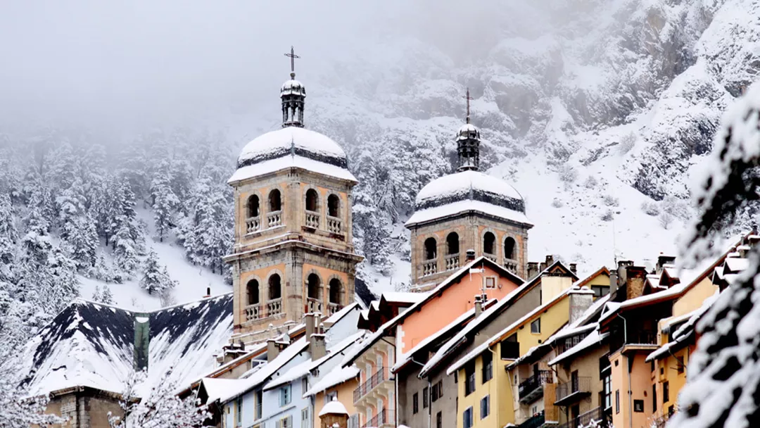
What is the weather like in Briançon in France, and what is the forecast for the next few days? Check the current weather forecast for Briançon on this page. Here, you will find the weather forecast for the next 48 hours as well as the next 14 days, so you’ll know exactly what to expect and what the weather will be like in Briançon during your winter holiday.
The weather in Briançon
On this page, you will find the current weather forecast for Briançon, located in the ski resort of Serre Chevalier in France. Check the forecast and temperature for both the valley and the mountain. This will help you see what conditions will be like on the slopes and whether you need to add an extra layer for the day’s skiing. Will snow be in the forecast, or will the sun be shining? And what about the wind? How high is the frost line (0-degree limit), and what is the current snow depth in Briançon? Read on for all this information!
Jump directly to:
48-hour weather forecast for Briançon
23 March 2026
Night
Expectation 0 mm
0-degree limit 1484 metres

-2°C

Morning
Expectation 0 mm
0-degree limit 1750 metres

5°C

Midday
Expectation 0 mm
0-degree limit 2096 metres

9°C

Evening
Expectation 0 mm
0-degree limit 1932 metres

2°C

24 March 2026
Night
Expectation 0 mm
0-degree limit 1801 metres

0°C

Morning
Expectation 0 mm
0-degree limit 2020 metres

7°C

Midday
Expectation 0 mm
0-degree limit 2398 metres

11°C

Evening
Expectation 0 mm
0-degree limit 2156 metres

4°C

23 March 2026
Night
Expectation 0 mm
0-degree limit 1434 metres

-12°C

Morning
Expectation 0 mm
0-degree limit 1651 metres

-9°C

Midday
Expectation 0 mm
0-degree limit 1996 metres

-6°C

Evening
Expectation 0 mm
0-degree limit 1862 metres

-9°C

24 March 2026
Night
Expectation 0 mm
0-degree limit 1776 metres

-10°C

Morning
Expectation 0 mm
0-degree limit 2019 metres

-6°C

Midday
Expectation 0 mm
0-degree limit 2394 metres

-3°C

Evening
Expectation 0 mm
0-degree limit 2195 metres

-6°C

14-day weather forecast for Briançon
Date
Weather and snow
Expectation
Wind
Frost line
Date
Weather and snow
Expectation
Wind
Frost line


1431 metres
Date
Weather and snow
Expectation
Wind
Frost line


1792 metres
Date
Weather and snow
Expectation
Wind
Frost line


1444 metres
Date
Weather and snow
Expectation
Wind
Frost line


1348 metres
Date
Weather and snow
Expectation
Wind
Frost line


718 metres
Date
Weather and snow
Expectation
Wind
Frost line


634 metres
Date
Weather and snow
Expectation
Wind
Frost line


933 metres
Date
Weather and snow
Expectation
Wind
Frost line


1243 metres
Date
Weather and snow
Expectation
Wind
Frost line


1644 metres
Date
Weather and snow
Expectation
Wind
Frost line


1904 metres
Date
Weather and snow
Expectation
Wind
Frost line


1886 metres
Date
Weather and snow
Expectation
Wind
Frost line


1766 metres
Date
Weather and snow
Expectation
Wind
Frost line


1754 metres
Date
Weather and snow
Expectation
Wind
Frost line


1661 metres
Date
Weather and snow
Expectation
Wind
Frost line


1379 metres
Date
Weather and snow
Expectation
Wind
Frost line


1774 metres
Date
Weather and snow
Expectation
Wind
Frost line


1326 metres
Date
Weather and snow
Expectation
Wind
Frost line


1249 metres
Date
Weather and snow
Expectation
Wind
Frost line


718 metres
Date
Weather and snow
Expectation
Wind
Frost line


634 metres
Date
Weather and snow
Expectation
Wind
Frost line


933 metres
Date
Weather and snow
Expectation
Wind
Frost line


1243 metres
Date
Weather and snow
Expectation
Wind
Frost line


1644 metres
Date
Weather and snow
Expectation
Wind
Frost line


1904 metres
Date
Weather and snow
Expectation
Wind
Frost line


1886 metres
Date
Weather and snow
Expectation
Wind
Frost line


1766 metres
Date
Weather and snow
Expectation
Wind
Frost line


1754 metres
Date
Weather and snow
Expectation
Wind
Frost line


1661 metres
Snow depth in Briançon
Snow is what makes a ski holiday special. Ideally, we wake up every day to Kaiser weather: a layer of fresh snow, bright sunshine, and a clear blue sky. However, icy temperatures and heavy snowfalls are also part of the experience. Or those foggy days when you ski from hut to hut, warming up with a cup of coffee, tea, or hot chocolate. When it comes to winter sports, the weather can be unpredictable, and nothing changes more rapidly than mountain weather. In addition to the forecast for the coming days, the current snow depth is a key part of the weather report in Briançon. How much snow is there on the mountain and in the valley of the Serre Chevalier ski area? Check the table below to see the current snow depth in Briançon.
Snow depth on the mountain and in the valley
Mountain: Not available cm
Valley: Not available cm
- Snow depth valley Not available
- Cross-country ski trails open (km) Not available
- Valley descent open Not available
- Hiking trails open (km) Not available
Set up SnowAlert for Briançon
Explanation of the weather forecast in Briançon
The weather report for Briançon is updated daily and is carefully compiled by meteorologists working with Snowplaza. Curious about the forecast for the next two days? Check out the 48-hour weather forecast, which provides information for the morning, afternoon, evening, and night. The symbols indicate whether snow or rain is expected, whether it will be cloudy, or if the sun will be shining. Click on "village" to see the weather conditions in the valley, and on "mountain" for forecasts at higher altitudes. The zero-degree line indicates the frost line, which changes depending on the temperature. Don't confuse it with the snowline—snow can still fall several hundred meters below the zero-degree line. For a longer-term outlook, check the 14-day weather forecast for Briançon. Keep in mind that weather conditions can change dramatically over two weeks, so be sure to check back daily if you're planning a winter sports trip soon.


