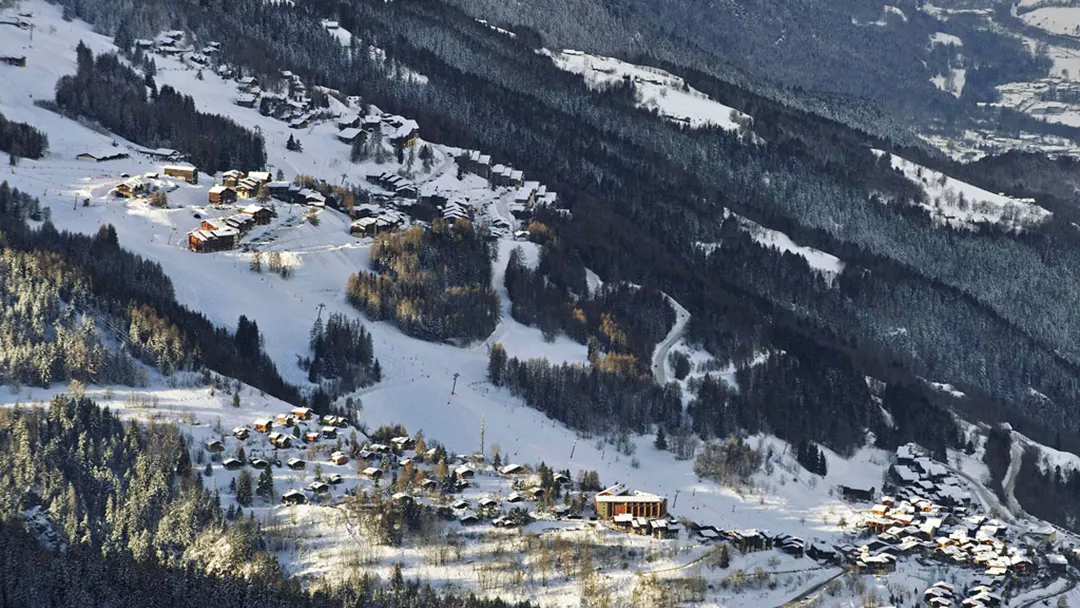
What is the weather like in Montchavin Les Coches in France, and what is the forecast for the next few days? Check the current weather forecast for Montchavin Les Coches on this page. Here, you will find the weather forecast for the next 48 hours as well as the next 14 days, so you’ll know exactly what to expect and what the weather will be like in Montchavin Les Coches during your winter holiday.
The weather in Montchavin Les Coches
On this page, you will find the current weather forecast for Montchavin Les Coches, located in the ski resort of Paradiski in France. Check the forecast and temperature for both the valley and the mountain. This will help you see what conditions will be like on the slopes and whether you need to add an extra layer for the day’s skiing. Will snow be in the forecast, or will the sun be shining? And what about the wind? How high is the frost line (0-degree limit), and what is the current snow depth in Montchavin Les Coches? Read on for all this information!
Jump directly to:
48-hour weather forecast for Montchavin Les Coches
12 May 2026
Night
Expectation 5 mm
0-degree limit 2050 metres

6°C

Morning
Expectation 0 mm
0-degree limit 1779 metres

5°C

Midday
Expectation 0 mm
0-degree limit 2201 metres

14°C

Evening
Expectation 0 mm
0-degree limit 2193 metres

9°C

13 May 2026
Night
Expectation 0 mm
0-degree limit 1872 metres

5°C

Morning
Expectation 0 mm
0-degree limit 1913 metres

6°C

Midday
Expectation 0 mm
0-degree limit 2297 metres

16°C

Evening
Expectation 0 mm
0-degree limit 2095 metres

10°C

12 May 2026
Night
Expectation 5 cm
0-degree limit 1892 metres

-8°C

Morning
Expectation 0 mm
0-degree limit 1676 metres

-10°C

Midday
Expectation 0 mm
0-degree limit 2330 metres

-4°C

Evening
Expectation 0 mm
0-degree limit 2411 metres

-6°C

13 May 2026
Night
Expectation 0 mm
0-degree limit 2204 metres

-7°C

Morning
Expectation 0 mm
0-degree limit 1960 metres

-6°C

Midday
Expectation 0 mm
0-degree limit 2262 metres

-5°C

Evening
Expectation 0 mm
0-degree limit 2027 metres

-8°C

14-day weather forecast for Montchavin Les Coches
Date
Weather and snow
Expectation
Wind
Frost line
Date
Weather and snow
Expectation
Wind
Frost line


1721 metres
Date
Weather and snow
Expectation
Wind
Frost line


1825 metres
Date
Weather and snow
Expectation
Wind
Frost line


1599 metres
Date
Weather and snow
Expectation
Wind
Frost line


1361 metres
Date
Weather and snow
Expectation
Wind
Frost line


1320 metres
Date
Weather and snow
Expectation
Wind
Frost line


1434 metres
Date
Weather and snow
Expectation
Wind
Frost line


2120 metres
Date
Weather and snow
Expectation
Wind
Frost line


2351 metres
Date
Weather and snow
Expectation
Wind
Frost line


2592 metres
Date
Weather and snow
Expectation
Wind
Frost line


2753 metres
Date
Weather and snow
Expectation
Wind
Frost line


2911 metres
Date
Weather and snow
Expectation
Wind
Frost line


2985 metres
Date
Weather and snow
Expectation
Wind
Frost line


3062 metres
Date
Weather and snow
Expectation
Wind
Frost line


3056 metres
Date
Weather and snow
Expectation
Wind
Frost line


1647 metres
Date
Weather and snow
Expectation
Wind
Frost line


1915 metres
Date
Weather and snow
Expectation
Wind
Frost line


1588 metres
Date
Weather and snow
Expectation
Wind
Frost line


1434 metres
Date
Weather and snow
Expectation
Wind
Frost line


1433 metres
Date
Weather and snow
Expectation
Wind
Frost line


1451 metres
Date
Weather and snow
Expectation
Wind
Frost line


2146 metres
Date
Weather and snow
Expectation
Wind
Frost line


2365 metres
Date
Weather and snow
Expectation
Wind
Frost line


2607 metres
Date
Weather and snow
Expectation
Wind
Frost line


2763 metres
Date
Weather and snow
Expectation
Wind
Frost line


2924 metres
Date
Weather and snow
Expectation
Wind
Frost line


2995 metres
Date
Weather and snow
Expectation
Wind
Frost line


3071 metres
Date
Weather and snow
Expectation
Wind
Frost line


3066 metres
Snow depth in Montchavin Les Coches
Snow is what makes a ski holiday special. Ideally, we wake up every day to Kaiser weather: a layer of fresh snow, bright sunshine, and a clear blue sky. However, icy temperatures and heavy snowfalls are also part of the experience. Or those foggy days when you ski from hut to hut, warming up with a cup of coffee, tea, or hot chocolate. When it comes to winter sports, the weather can be unpredictable, and nothing changes more rapidly than mountain weather. In addition to the forecast for the coming days, the current snow depth is a key part of the weather report in Montchavin Les Coches. How much snow is there on the mountain and in the valley of the Paradiski ski area? Check the table below to see the current snow depth in Montchavin Les Coches.
Snow depth on the mountain and in the valley
Mountain: 0 cm
Valley: 0 cm
- Snow depth valley 0
- Cross-country ski trails open (km) 0
- Valley descent open Closed
- Hiking trails open (km) 0
Pistes Paradiski
Set up SnowAlert for Montchavin Les Coches
Explanation of the weather forecast in Montchavin Les Coches
The weather report for Montchavin Les Coches is updated daily and is carefully compiled by meteorologists working with Snowplaza. Curious about the forecast for the next two days? Check out the 48-hour weather forecast, which provides information for the morning, afternoon, evening, and night. The symbols indicate whether snow or rain is expected, whether it will be cloudy, or if the sun will be shining. Click on "village" to see the weather conditions in the valley, and on "mountain" for forecasts at higher altitudes. The zero-degree line indicates the frost line, which changes depending on the temperature. Don't confuse it with the snowline—snow can still fall several hundred meters below the zero-degree line. For a longer-term outlook, check the 14-day weather forecast for Montchavin Les Coches. Keep in mind that weather conditions can change dramatically over two weeks, so be sure to check back daily if you're planning a winter sports trip soon.


