Skip to navigation Skip to main content
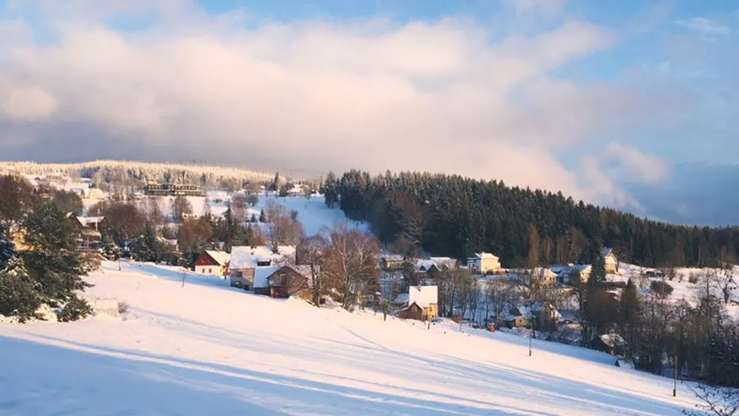
Afbeelding - Benecko
© Facebook Benecko

What is the weather like in Benecko in Czech Republic, and what is the forecast for the next few days? Check the current weather forecast for Benecko on this page. Here, you will find the weather forecast for the next 48 hours as well as the next 14 days, so you’ll know exactly what to expect and what the weather will be like in Benecko during your winter holiday.

The weather in Benecko

On this page, you will find the current weather forecast for Benecko, located in the ski resort of Benecko in Czech Republic. Check the forecast and temperature for both the valley and the mountain. This will help you see what conditions will be like on the slopes and whether you need to add an extra layer for the day’s skiing. Will snow be in the forecast, or will the sun be shining? And what about the wind? How high is the frost line (0-degree limit), and what is the current snow depth in Benecko? Read on for all this information!

Jump directly to:

48-hour weather forecast for Benecko

15 November 2025

Night

Expectation 0 mm

0-degree limit 2972 metres

Overcast

2°C

Nno 1
Morning

Expectation 0 mm

0-degree limit 2903 metres

Regular sunshine with some clouds

6°C

Ozo 1
Midday

Expectation 0 mm

0-degree limit 2777 metres

Extensive cloud cover, hardly any sun

8°C

Zzo 1
Evening

Expectation 1 mm

0-degree limit 2514 metres

Cloudy and some rain

5°C

O 1

16 November 2025

Night

Expectation 1 mm

0-degree limit 2429 metres

Cloudy and some rain

3°C

Ozo 1
Morning

Expectation 1 mm

0-degree limit 2315 metres

Cloudy, grey and drizzling

6°C

Zzw 2
Midday

Expectation 1 mm

0-degree limit 2265 metres

Cloudy, grey and drizzling

7°C

Zzw 2
Evening

Expectation 1 mm

0-degree limit 2026 metres

Cloudy, grey and drizzling

5°C

Zzw 1

15 November 2025

Night

Expectation 0 mm

0-degree limit 2902 metres

Overcast

4°C

Nnw 1
Morning

Expectation 0 mm

0-degree limit 2903 metres

Regular sunshine with some clouds

6°C

O 2
Midday

Expectation 0 mm

0-degree limit 2737 metres

Extensive cloud cover, hardly any sun

7°C

O 2
Evening

Expectation 1 mm

0-degree limit 2516 metres

Cloudy and some rain

5°C

Z 1

16 November 2025

Night

Expectation 1 mm

0-degree limit 2432 metres

Cloudy and some rain

3°C

Z 1
Morning

Expectation 1 mm

0-degree limit 2316 metres

Cloudy, grey and drizzling

5°C

Zw 3
Midday

Expectation 1 mm

0-degree limit 2266 metres

Cloudy, grey and drizzling

6°C

Zw 3
Evening

Expectation 1 mm

0-degree limit 2027 metres

Cloudy, grey and drizzling

5°C

Zw 2

14-day weather forecast for Benecko

Date

Weather and snow

Expectation

Wind

Frost line

Date

Weather and snow

Expectation

Wind

Frost line

15 November 2025
Extensive cloud cover, hardly any sun
2°C / 8°C
1 mm
Zzo 1

2430 metres

Date

Weather and snow

Expectation

Wind

Frost line

16 November 2025
Cloudy, grey and drizzling
3°C / 7°C
1 mm
Zzw 2

1921 metres

Date

Weather and snow

Expectation

Wind

Frost line

17 November 2025
Mix of rain, sleet and snow
-2°C / 2°C
9 mm
Nw 2

644 metres

Date

Weather and snow

Expectation

Wind

Frost line

18 November 2025
Regular sunshine with some clouds
-5°C / -1°C
1 mm
Wzw 2

537 metres

Date

Weather and snow

Expectation

Wind

Frost line

19 November 2025
Bright sunny weather
-4°C / 0°C
0 mm
Z 2

201 metres

Date

Weather and snow

Expectation

Wind

Frost line

20 November 2025
Regular sunshine with some clouds
-4°C / 0°C
1 mm
Zzw 3

132 metres

Date

Weather and snow

Expectation

Wind

Frost line

21 November 2025
Regular sunshine with some clouds
-4°C / 0°C
1 mm
Wnw 2

206 metres

Date

Weather and snow

Expectation

Wind

Frost line

22 November 2025
Regular sunshine with some clouds
-4°C / 0°C
1 mm
Zzo 3

206 metres

Date

Weather and snow

Expectation

Wind

Frost line

23 November 2025
Mix of rain, sleet and snow
-3°C / 2°C
2 mm
Zw 3

554 metres

Date

Weather and snow

Expectation

Wind

Frost line

24 November 2025
Wet snow with some sunshine
-2°C / 2°C
3 mm
Wzw 3

853 metres

Date

Weather and snow

Expectation

Wind

Frost line

25 November 2025
Slippery conditions due to black ice or freezing rain
-1°C / 3°C
2 mm
Zw 3

973 metres

Date

Weather and snow

Expectation

Wind

Frost line

26 November 2025
Slippery conditions due to black ice or freezing rain
-1°C / 3°C
5 mm
Zw 3

1009 metres

Date

Weather and snow

Expectation

Wind

Frost line

27 November 2025
Slippery conditions due to black ice or freezing rain
-1°C / 3°C
3 mm
Wzw 3

1103 metres

Date

Weather and snow

Expectation

Wind

Frost line

28 November 2025
Slippery conditions due to black ice or freezing rain
-1°C / 3°C
5 mm
Wzw 3

991 metres

Date

Weather and snow

Expectation

Wind

Frost line

15 November 2025
Extensive cloud cover, hardly any sun
4°C /7°C
1 mm
O 2

2432 metres

Date

Weather and snow

Expectation

Wind

Frost line

16 November 2025
Cloudy, grey and drizzling
3°C /6°C
1 mm
Zw 3

1920 metres

Date

Weather and snow

Expectation

Wind

Frost line

17 November 2025
Mix of rain, sleet and snow
-3°C /0°C
9 mm
N 3

642 metres

Date

Weather and snow

Expectation

Wind

Frost line

18 November 2025
Regular sunshine with some clouds
-5°C /-2°C
1 mm
Wzw 4

538 metres

Date

Weather and snow

Expectation

Wind

Frost line

19 November 2025
Bright sunny weather
-5°C /-2°C
0 mm
Zzw 3

201 metres

Date

Weather and snow

Expectation

Wind

Frost line

20 November 2025
Regular sunshine with some clouds
-5°C /-2°C
1 mm
Zzw 3

132 metres

Date

Weather and snow

Expectation

Wind

Frost line

21 November 2025
Regular sunshine with some clouds
-5°C /-2°C
1 mm
Wnw 3

206 metres

Date

Weather and snow

Expectation

Wind

Frost line

22 November 2025
Regular sunshine with some clouds
-5°C /-1°C
1 mm
Zzo 3

206 metres

Date

Weather and snow

Expectation

Wind

Frost line

23 November 2025
Mix of rain, sleet and snow
-3°C /1°C
2 mm
Zw 3

554 metres

Date

Weather and snow

Expectation

Wind

Frost line

24 November 2025
Wet snow with some sunshine
-3°C /1°C
3 mm
Wzw 4

853 metres

Date

Weather and snow

Expectation

Wind

Frost line

25 November 2025
Mix of rain, sleet and snow
-2°C /2°C
2 mm
Zw 4

973 metres

Date

Weather and snow

Expectation

Wind

Frost line

26 November 2025
Mix of rain, sleet and snow
-2°C /2°C
5 mm
Zw 4

1009 metres

Date

Weather and snow

Expectation

Wind

Frost line

27 November 2025
Mix of rain, sleet and snow
-1°C /2°C
3 mm
Wzw 4

1103 metres

Date

Weather and snow

Expectation

Wind

Frost line

28 November 2025
Mix of rain, sleet and snow
-2°C /2°C
5 mm
Wzw 4

991 metres

Snow depth in Benecko

Snow is what makes a ski holiday special. Ideally, we wake up every day to Kaiser weather: a layer of fresh snow, bright sunshine, and a clear blue sky. However, icy temperatures and heavy snowfalls are also part of the experience. Or those foggy days when you ski from hut to hut, warming up with a cup of coffee, tea, or hot chocolate. When it comes to winter sports, the weather can be unpredictable, and nothing changes more rapidly than mountain weather. In addition to the forecast for the coming days, the current snow depth is a key part of the weather report in Benecko. How much snow is there on the mountain and in the valley of the Benecko ski area? Check the table below to see the current snow depth in Benecko.

Snow depth on the mountain and in the valley

Mountain: Not available cm

Valley: Not available cm

  • Snow depth valley Not available
  • Cross-country ski trails open (km) Not available
  • Valley descent open Not available
  • Hiking trails open (km) Not available
Set up SnowAlert for Benecko

Set up SnowAlert for Benecko

With fresh snowfall, receive snow depth updates up to 3 times a week.

Explanation of the weather forecast in Benecko

The weather report for Benecko is updated daily and is carefully compiled by meteorologists working with Snowplaza. Curious about the forecast for the next two days? Check out the 48-hour weather forecast, which provides information for the morning, afternoon, evening, and night. The symbols indicate whether snow or rain is expected, whether it will be cloudy, or if the sun will be shining. Click on "village" to see the weather conditions in the valley, and on "mountain" for forecasts at higher altitudes. The zero-degree line indicates the frost line, which changes depending on the temperature. Don't confuse it with the snowline—snow can still fall several hundred meters below the zero-degree line. For a longer-term outlook, check the 14-day weather forecast for Benecko. Keep in mind that weather conditions can change dramatically over two weeks, so be sure to check back daily if you're planning a winter sports trip soon.